


High Atlas Mountains – in 5 photos
Views, villages and traditions between Morocco's highest peaks

If you’ve arrived here from somewhere on the web – welcome! NE Where is a an independent, travel-focussed journal for those who travel, and other curious people. Free newsletters are sent out every two weeks, and there is an option to sign up as a paying member too. For $5 a month (or $50 a year) benefits include tailored travel recommendations and full access to NE Where’s archive (which is packed with stories about exceptional women, and other tales about interesting people and places), as well as access to the NE Where On The Road WhatsApp group, where I share pics and snippets as I travel.

High Atlas Mountains – in 5 photos
Views, villages and traditions between Morocco’s highest peaks
Dear NE-One
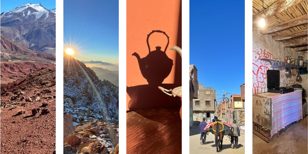
In the far north of Africa, where the Sahara desert rolls her dunes between the broad belly of the continent and the western bulge of Europe, there is a range of mountains that stands in her way. Formed when tectonic plates collided, the slopes of the High Atlas stretch for 740km across Morocco, from the Atlantic coast near Agadir all the way to Algeria, creating a barrier for weather systems and giving birth to rivers that nurture fertile valleys and bring sustenance to some of Morocco’s most thirsty lands.
Keep reading with a 7-day free trial
Subscribe to Travel: NE Where to keep reading this post and get 7 days of free access to the full post archives.